What can be shown, not just said
Eight things about PaveKeep can be demonstrated on a working network rather than described. Each one below names the artefact behind it — a screen of the running product, or a document it produced — and you can open the artefact.
The documents are the real output, not illustrations of it: the three booklets are the files a council would file, and the two evidence packs are the same report generated as at two different dates. Every one is committed to the repository with its SHA-256, so the file you download is the file that was reviewed.
P1 · Every number can be traced back
which survey, which setting, which piece of arithmetic. The software explains itself rather than asking to be trusted.
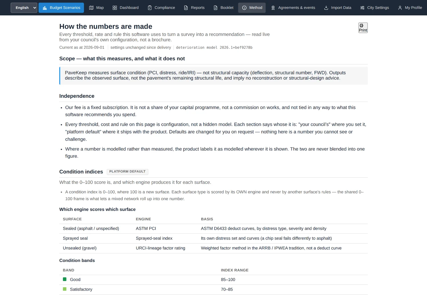
P2 · A sealed road, a sprayed-seal road and a gravel road are scored by different methods, because they fail in different ways
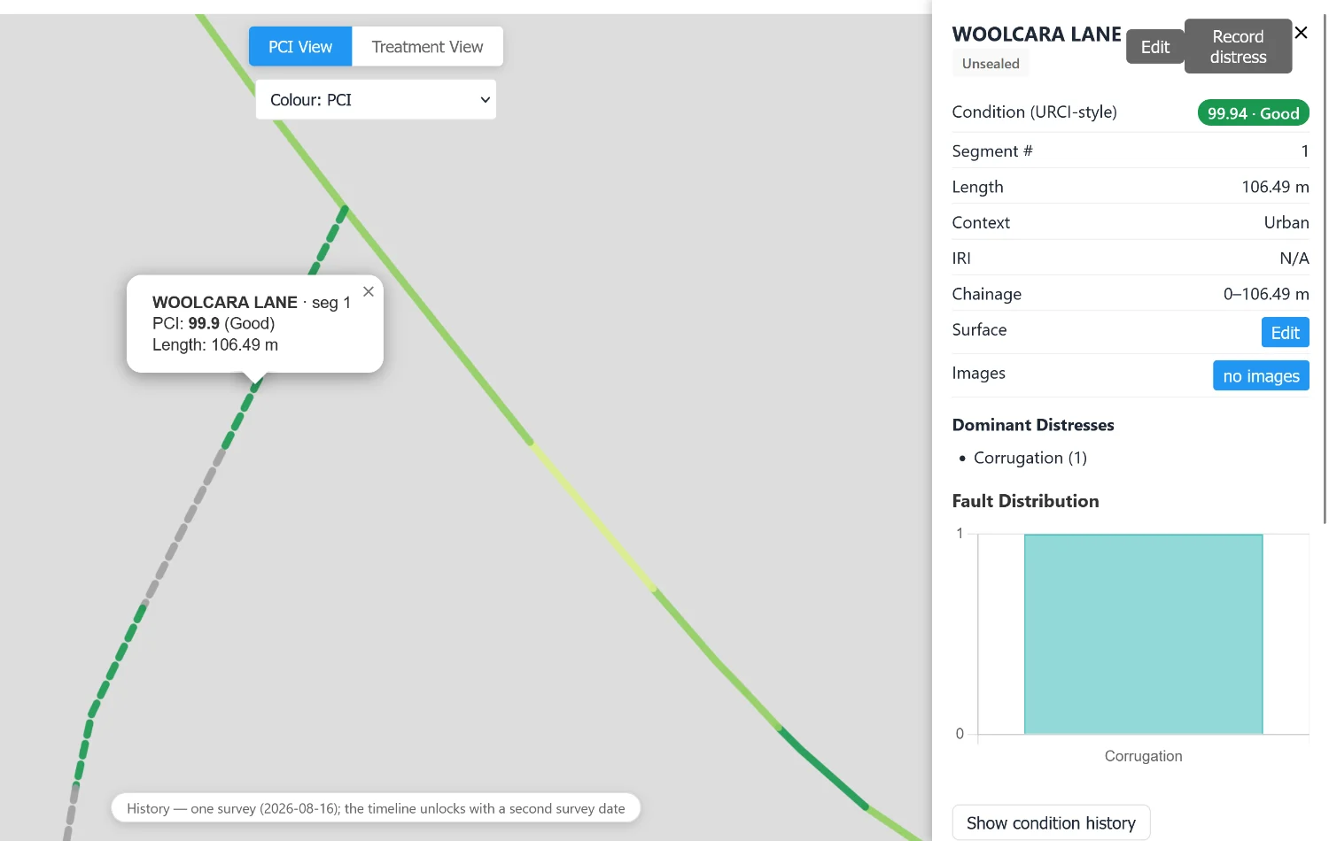
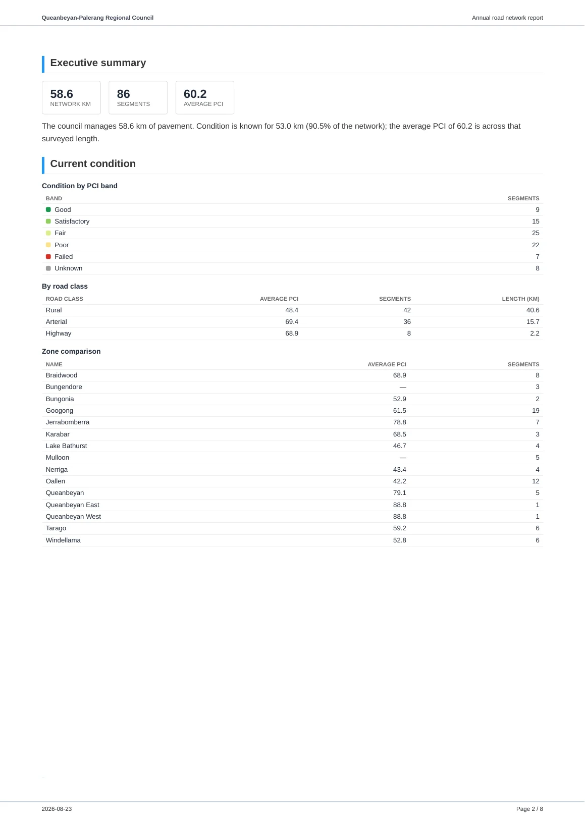
P3 · A road nobody has surveyed is reported as unknown, never as zero and never quietly averaged away
This is the one councils test us on.
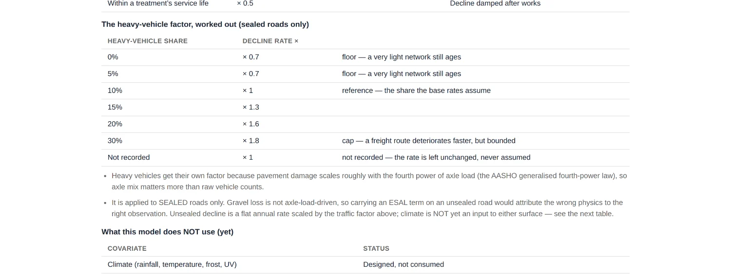
P4 · Heavy vehicle traffic changes how fast a road is expected to wear out, and the change is visible rather than buried in a model
P5 · The network as it stood on any past date — what an auditor or a funding body asks for when they reopen a claim
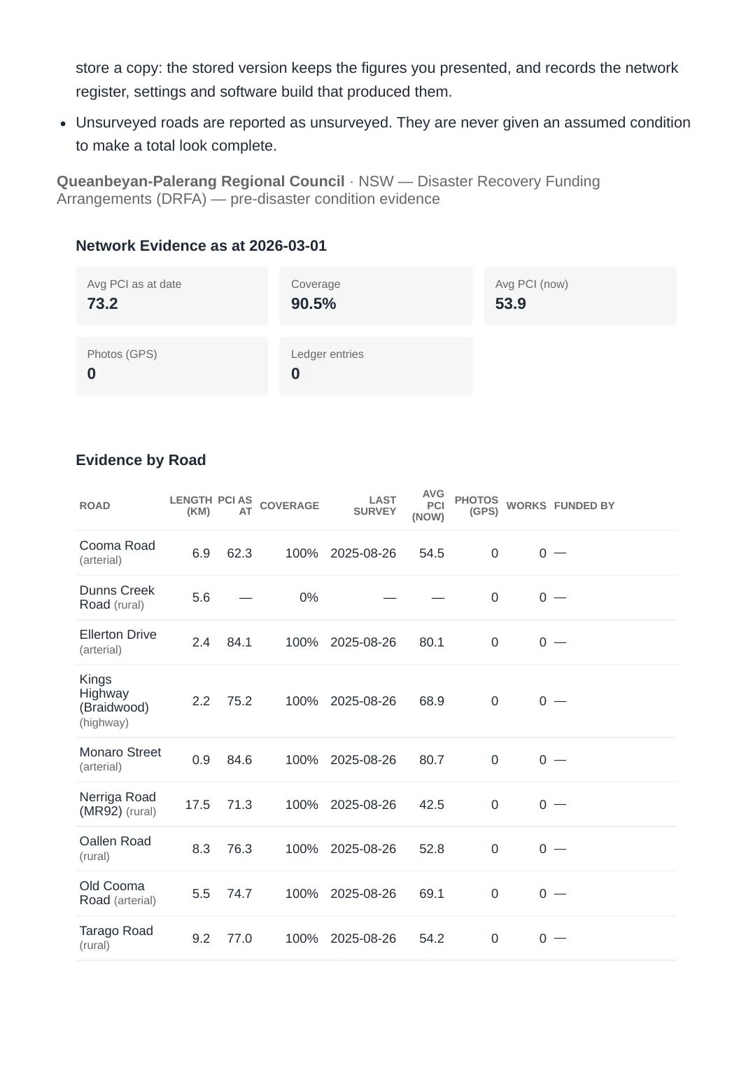
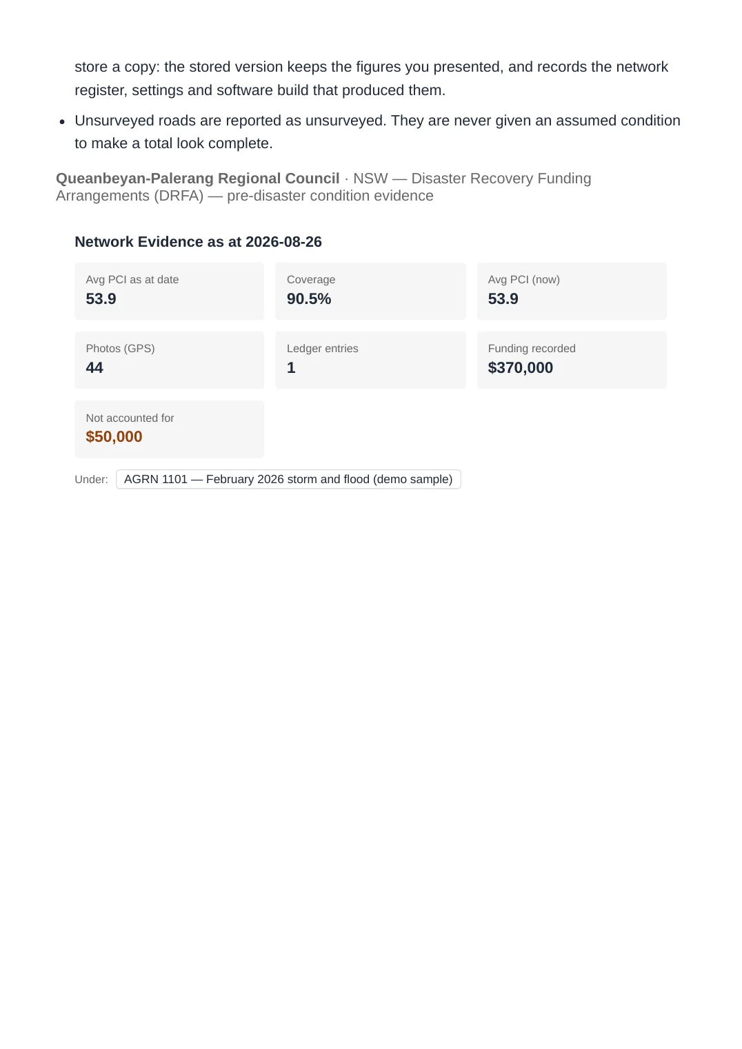
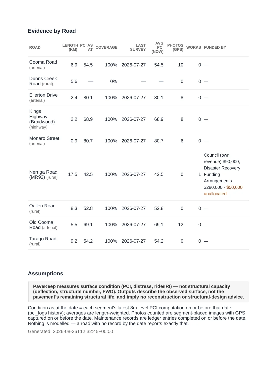
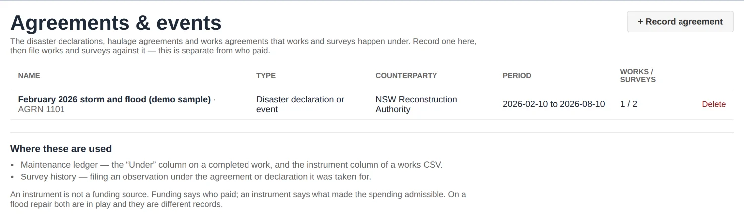
P6 · A chain from the survey, to the work done, to who paid for it, to the declaration it happened under
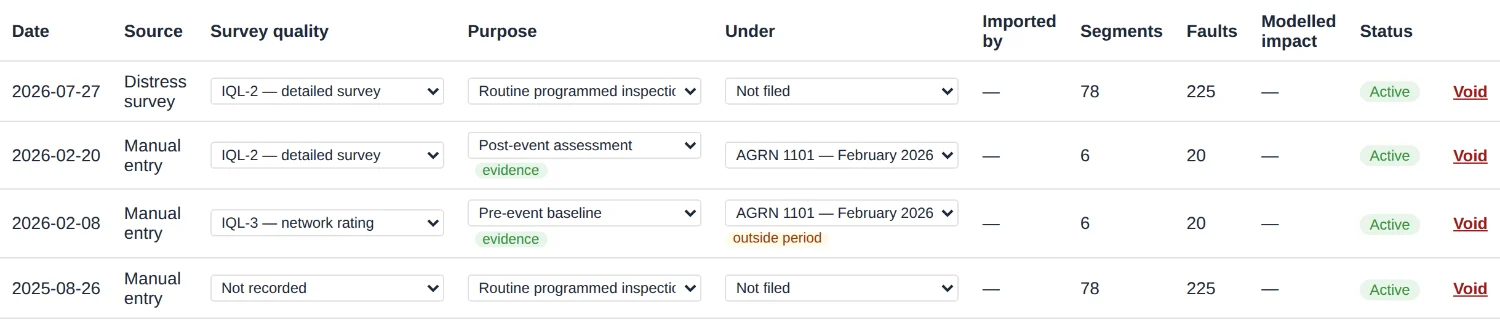

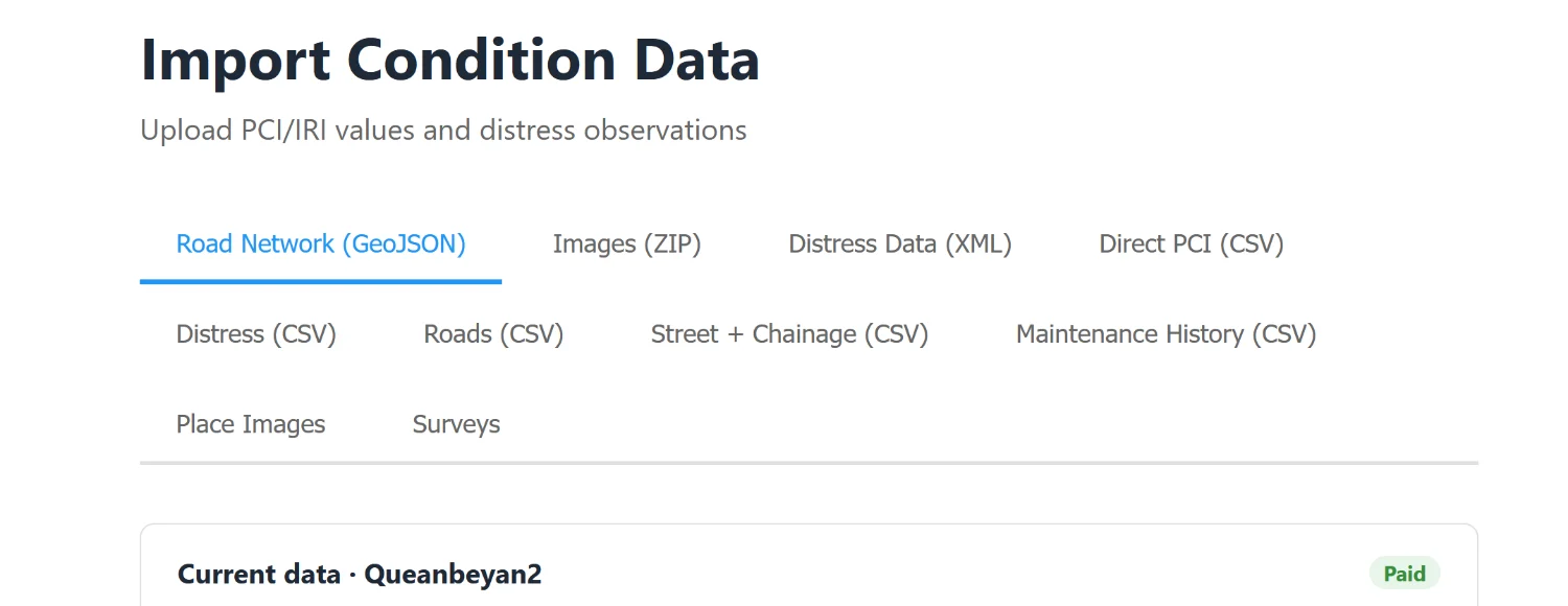
P7 · It sits beside the systems a council already has rather than demanding they be replaced
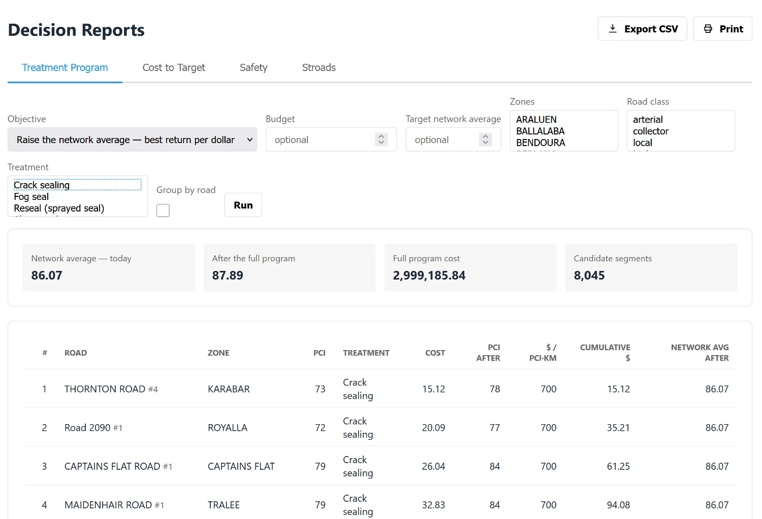
P8 · From a spreadsheet of roads to a defensible works programme, measured, without a consultant in between
The artefacts, to open or download
These are files, not pictures of files.
- evidence-pack-as-at-2026-03-01.pdf — 73 KB
- evidence-pack-as-at-2026-08-26.pdf — 87 KB
- booklet-committee.pdf — 603 KB
- booklet-executive.pdf — 249 KB
- booklet-grant.pdf — 616 KB
- exports-gis-sample.geojson — 37 KB
Their hashes are published with the pack: see docs/PROOF_EXECUTION_MAP.md and the manifest beside it.